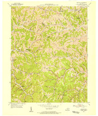
1953 Map of Webbville
USGS Topo · Published 1955About this map
Webbville serves as a focal point for this 1950s survey of Lawrence County, where the landscape is defined by the winding Little Fork and the Little Sandy River. The map reveals a dense network of rural infrastructure typical of mid-century eastern Kentucky, featuring a high concentration of localized education and faith centers such as the Old Kentucky Home Sch, Brammer Gap Sch, and the Dry Fork Community Ch. The topography is a maze of drainage basins, with named hollows and branches like Coal Branch and Muddy Branch dictating the placement of early settlements and family cemeteries.
Find a feature on this map
46 named features on this map. Tap any name to fly to it.
Don’t see what you’re looking for? This feature index may not catch every label — zoom into the map to look around manually.
Map Details
Editions of this 1953 Webbville Map
3 editions found
Other maps of this area

1901 · Ceredo
USGS Topo · 1:62,500

1903 · Kenova
USGS Topo · 1:125,000

1904 · Kenova
USGS Topo · 1:125,000

1911 · Louisa
USGS Topo · 1:48,000

1913 · Ceredo
USGS Topo · 1:62,500

1913 · Louisa
USGS Topo · 1:62,500

1939 · Louisa
USGS Topo · 1:62,500

1953 · Grayson
USGS Topo · 1:24,000

1953 · Rush
USGS Topo · 1:24,000

1953 · Boltsfork
USGS Topo · 1:24,000