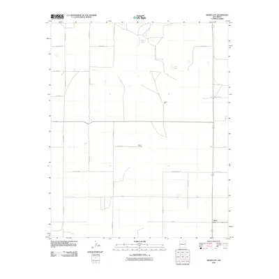
2010 Map of Weber City
USGS Topo · Published 2010About this map
Yeakley Cemetery stands as a focal point for local heritage in this rural landscape near the border of Curry and Quay Counties. The map reveals a highly structured grid of section lines and secondary routes, including Quay Road 33 and Curry Road 29, which facilitate movement between scattered agricultural homesteads. The small settlement of Weber City occupies the lower right corner, serving as a primary point of reference for the surrounding plains.
Find a feature on this map
19 named features on this map. Tap any name to fly to it.
Don’t see what you’re looking for? This feature index may not catch every label — zoom into the map to look around manually.
Map Details
Editions of this 2010 Weber City Map
This is the sole edition of this map. No revisions or reprints were ever made.
Other maps of this area

1954 · Clovis
USGS Topo · 1:250,000

1958 · Clovis
USGS Topo · 1:250,000

1970 · Jordan
USGS Topo · 1:24,000

1971 · Ragland
USGS Topo · 1:24,000

1971 · Forrest
USGS Topo · 1:24,000

1973 · Weber City
USGS Topo · 1:24,000

1973 · Field SE
USGS Topo · 1:24,000

1973 · Mc Alister
USGS Topo · 1:24,000

1973 · Field SW
USGS Topo · 1:24,000
1973 · House SE
USGS Topo · 1:24,000