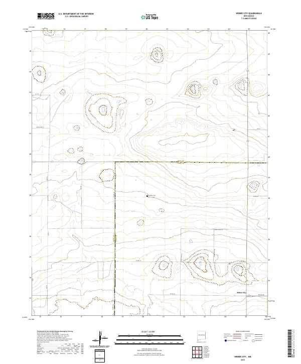
2023 Map of Weber City
USGS Topo · Published 2023About this map
Quay and Curry County boundaries intersect in this high plains landscape of eastern New Mexico. The small settlement of Weber City anchors the southeast portion of the quadrangle, situated near the junction of several rural routes including Co Rd 26. The map illustrates a strictly organized township and range grid system, with the land divided by surveyed lines such as t6n r31e and t5n r30e. Sparse water resources are limited to small basins like Capps Lake and Law Lake, which highlight the arid nature of the region. Local history is represented by the isolated Yeakley Cem, a common feature in rural farming and ranching communities of the Llano Estacado. The road network, consisting of labels like Quay Road 31 and Curry Road Ak, traces the section lines, revealing the systematic agricultural development of the area.
Find a feature on this map
22 named features on this map. Tap any name to fly to it.
Don’t see what you’re looking for? This feature index may not catch every label — zoom into the map to look around manually.
Map Details
Editions of this 2023 Weber City Map
This is the sole edition of this map. No revisions or reprints were ever made.
Other maps of this area

1954 · Clovis
USGS Topo · 1:250,000

1958 · Clovis
USGS Topo · 1:250,000

1970 · Jordan
USGS Topo · 1:24,000

1971 · Ragland
USGS Topo · 1:24,000

1971 · Forrest
USGS Topo · 1:24,000

1973 · Weber City
USGS Topo · 1:24,000

1973 · Field SE
USGS Topo · 1:24,000

1973 · Mc Alister
USGS Topo · 1:24,000

1973 · Field SW
USGS Topo · 1:24,000
1973 · House SE
USGS Topo · 1:24,000