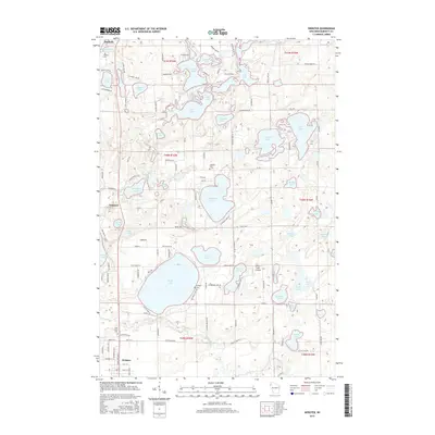
2015 Map of Webster
USGS Topo · Published 2015About this map
Danbury and Webster anchor the north and south of this Burnett County landscape, characterized by an exceptionally high density of glacial kettle lakes and wetlands. The settlement at Oakland sits centrally, surrounded by water bodies including Johnson Lake, Fremstadt Lake, and Mud Lake. The cartography details a network of rural routes such as Flowage Dr and Mail Rd that navigate the narrow strips of land between these basins. Local history is preserved in sites like Oak Grove Cem near Webster and Danbury Cem to the north, alongside specialized landmarks like Connor's Lake Landing. The intricate shoreline of Minerva Lake and the nearby Minerva Dam Rd suggest a history of water management and recreation in this densely lakeland region.
Find a feature on this map
128 named features on this map. Tap any name to fly to it.
Don’t see what you’re looking for? This feature index may not catch every label — zoom into the map to look around manually.
Map Details
Editions of this 2015 Webster Map
This is the sole edition of this map. No revisions or reprints were ever made.
Other maps of this area

1949 · Danbury
USGS Topo · 1:48,000

1949 · Hertel
USGS Topo · 1:48,000

1949 · Webb Lake
USGS Topo · 1:48,000

1950 · Webster
USGS Topo · 1:48,000

1953 · Duluth
USGS Topo · 1:250,000

1953 · Stillwater
USGS Topo · 1:250,000

1955 · Hertel
USGS Topo · 1:62,500

1955 · Webb Lake
USGS Topo · 1:62,500

1955 · Webster
USGS Topo · 1:62,500

1955 · Stillwater
USGS Topo · 1:250,000