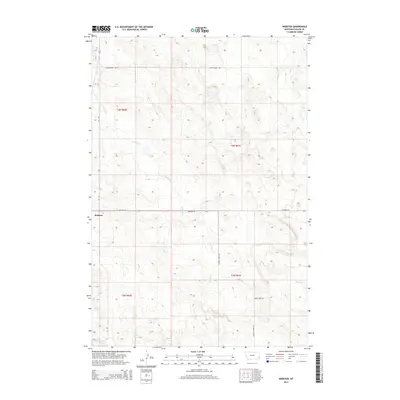
2014 Map of Webster
USGS Topo · Published 2014About this map
Webster serves as a central point in this remote corner of Fallon County, Montana, situated at the junction of several arterial rural routes. The landscape is defined by the headwaters and drainage patterns of Chimney Cr, Mud Cr, and Soda Cr, which carve through the high plains. This 2014 representation captures a contemporary look at the section lines and township boundaries that organize the ranching country, including t4n r60e and t4n r61e. The road network, including Little Beaver Rd and Soda Creek Rd, follows the natural contours and drainage of the land, illustrating how modern transportation still relies on the topography established by these intermittent watercourses.
Find a feature on this map
13 named features on this map. Tap any name to fly to it.
Don’t see what you’re looking for? This feature index may not catch every label — zoom into the map to look around manually.
Map Details
Editions of this 2014 Webster Map
This is the sole edition of this map. No revisions or reprints were ever made.
Other maps of this area

1953 · Miles City
USGS Topo · 1:250,000

1954 · Ekalaka
USGS Topo · 1:250,000

1956 · Ekalaka
USGS Topo · 1:250,000

1957 · Miles City
USGS Topo · 1:250,000

1958 · Miles City
USGS Topo · 1:250,000

1958 · Ekalaka
USGS Topo · 1:250,000

1965 · Ekalaka
USGS Topo · 1:250,000

1980 · Dutchmans Hill
USGS Topo · 1:24,000
1980 · Flasted Hill
USGS Topo · 1:24,000
1980 · Snider Hill
USGS Topo · 1:24,000