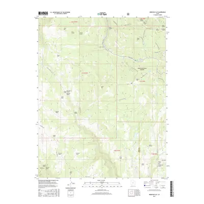
2017 Map of Webster Flat
USGS Topo · Published 2017About this map
Dixie National Forest defines the high-altitude terrain of this 2017 survey, where the convergence of Iron and Kane counties meets the northern reaches of Washington County. The landscape is characterized by a complex network of drainage basins and prominent overlooks, including Miners Peak and Everstein Ridge in the southwest and Sherratt Point further north. This area serves as a significant hydrological source, with Deep Creek and its forks carving through the Kolob Terrace.
Find a feature on this map
61 named features on this map. Tap any name to fly to it.
Don’t see what you’re looking for? This feature index may not catch every label — zoom into the map to look around manually.
Map Details
Editions of this 2017 Webster Flat Map
This is the sole edition of this map. No revisions or reprints were ever made.
Other maps of this area

1885 · St. George
USGS Topo · 1:250,000

1886 · Kanab
USGS Topo · 1:250,000

1891 · St. George
USGS Topo · 1:250,000

1950 · Cedar City
USGS Topo · 1:24,000

1950 · Cedar City
USGS Topo · 1:62,500

1950 · Cedar Mountain
USGS Topo · 1:24,000

1952 · Cedar Mountain
USGS Topo · 1:24,000

1953 · Cedar City
USGS Topo · 1:250,000

1954 · Orderville Canyon NW
USGS Topo · 1:24,000

1957 · Orderville Canyon NE
USGS Topo · 1:24,000