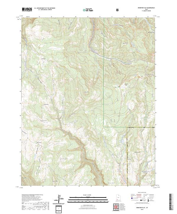
2023 Map of Webster Flat
USGS Topo · Published 2023About this map
Webster Flat and the surrounding high-elevation terrain of the Dixie National Forest define this 2023 survey of Iron County. The landscape is marked by a complex network of canyons and ridges, most notably the Ashdown Gorge Wilderness in the northeast and the prominent Miners Peak in the southwest. A high concentration of named hollows, such as Houchen Hollow and Dan Leigh Hollow, indicates a deeply eroded plateau where water sources like Lundell Spring and Aspen Lake provide critical points of interest in an otherwise arid environment.
Find a feature on this map
53 named features on this map. Tap any name to fly to it.
Don’t see what you’re looking for? This feature index may not catch every label — zoom into the map to look around manually.
Map Details
Editions of this 2023 Webster Flat Map
This is the sole edition of this map. No revisions or reprints were ever made.
Other maps of this area

1885 · St. George
USGS Topo · 1:250,000

1886 · Kanab
USGS Topo · 1:250,000

1891 · St. George
USGS Topo · 1:250,000

1950 · Cedar City
USGS Topo · 1:24,000

1950 · Cedar City
USGS Topo · 1:62,500

1950 · Cedar Mountain
USGS Topo · 1:24,000

1952 · Cedar Mountain
USGS Topo · 1:24,000

1953 · Cedar City
USGS Topo · 1:250,000

1954 · Orderville Canyon NW
USGS Topo · 1:24,000

1957 · Orderville Canyon NE
USGS Topo · 1:24,000