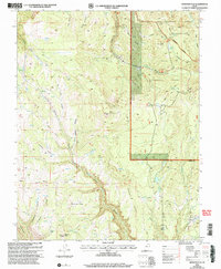
2002 Map of Webster Flat
USGS Topo · Published 2005About this map
Dixie National Forest covers much of this high-altitude landscape, where sharp drainage basins like Cedar Canyon and Ashdown Gorge cut through the high plateaus. The topography is defined by a series of prominent overlooks and family-named landmarks, including Sherratt Point, O'Neil Point, and Corry Point. Settlement is sparse, represented by Walts Flat, though the presence of the Deer Haven Campground and several Gravel Pits indicate the area's mid-century role as a gateway for recreation and local resource extraction. Hydrological features such as Crystal Spring and Aspen Lake are vital water sources in this complex terrain. The boundary between Iron and Kane Counties bisects the southern portion of the map near the headwaters of Three Creeks. Researchers can trace the extensive network of trails and 4WD tracks that navigated these peaks, including the climb to Miners Peak and the passage through the Ashdown Gorge Wilderness.
Find a feature on this map
50 named features on this map. Tap any name to fly to it.
Don’t see what you’re looking for? This feature index may not catch every label — zoom into the map to look around manually.
Map Details
Editions of this 2002 Webster Flat Map
This is the sole edition of this map. No revisions or reprints were ever made.
Other maps of this area

1885 · St. George
USGS Topo · 1:250,000

1886 · Kanab
USGS Topo · 1:250,000

1891 · St. George
USGS Topo · 1:250,000

1950 · Cedar City
USGS Topo · 1:24,000

1950 · Cedar City
USGS Topo · 1:62,500

1950 · Cedar Mountain
USGS Topo · 1:24,000

1952 · Cedar Mountain
USGS Topo · 1:24,000

1953 · Cedar City
USGS Topo · 1:250,000

1954 · Orderville Canyon NW
USGS Topo · 1:24,000

1957 · Orderville Canyon NE
USGS Topo · 1:24,000