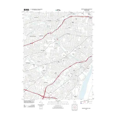
2012 Map of Webster Groves
USGS Topo · Published 2012About this map
Grants Farm and the sprawling grounds of Jefferson Barracks anchor this landscape, illustrating the suburban evolution of the region south and west of the city. The map reveals a dense network of residential growth and established neighborhoods, from Webster Groves to Brentwood and the distinctive cultural enclave of The Hill. This 2012 survey highlights an extraordinary concentration of memorial sites and historic burying grounds, such as Sunset Burial Park, Saint Paul Cemetery, and Old Saint Marcus Cemetery, which define large portions of the land use in communities like Affton and Lemay. The hydrology is dominated by the winding course of Gravois Creek and the engineered River des Peres Drainage Channel, while the Mississippi River marks the eastern boundary. Civic infrastructure is noted through numerous local facilities like the Maplewood Post Office and Charles J Coyle Post Office.
Find a feature on this map
170 named features on this map. Tap any name to fly to it.
Don’t see what you’re looking for? This feature index may not catch every label — zoom into the map to look around manually.
Map Details
Editions of this 2012 Webster Groves Map
This is the sole edition of this map. No revisions or reprints were ever made.
Other maps of this area

1888 · St. Louis
USGS Topo · 1:62,500

1910 · Waterloo
USGS Topo · 1:62,500

1912 · Kimmswick
USGS Topo · 1:62,500

1913 · Waterloo
USGS Topo · 1:62,500

1916 · Kimmswick
USGS Topo · 1:62,500

1933 · Creve Coeur
USGS Topo · 1:24,000

1933 · Granite City
USGS Topo · 1:24,000

1933 · Jefferson Barracks
USGS Topo · 1:24,000

1933 · Cahokia
USGS Topo · 1:24,000

1933 · Clayton
USGS Topo · 1:24,000