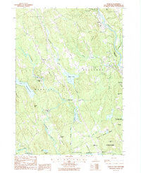
1987 Map of Webster
USGS Topo · Published 1987About this map
Blackwater River and the Merrimack River converge in this region of Merrimack County, shaping a landscape defined by historic mill sites and water management. The legacy of early industry is visible at Snyders Mill and Swetts Mills, while the later infrastructure of the Blackwater Dam stands north of Lake Winnepocket. Small crossroads settlements like Dingit Corner, Gerrish Corner, and Davisville are connected by a network of roads traversing named heights such as Corser Hill and Putney Hill. Further east, the river corridor supports the Merrimack River State Forest and the State Forest Nursery, alongside unique mid-century landmarks like a Drive-In Theater near Boscawen. The southern portion of the map transitions into the corporate boundaries of Concord, showing the development around Mast Yard near the Contoocook River.
Find a feature on this map
55 named features on this map. Tap any name to fly to it.
Don’t see what you’re looking for? This feature index may not catch every label — zoom into the map to look around manually.
Map Details
Editions of this 1987 Webster Map
2 editions found
Other maps of this area

1926 · Hillsboro
USGS Topo · 1:62,500

1927 · Concord
USGS Topo · 1:62,500

1927 · Penacook
USGS Topo · 1:62,500

1928 · Mount Kearsarge
USGS Topo · 1:62,500

1929 · Hillsboro
USGS Topo · 1:62,500

1931 · Mount Kearsarge
USGS Topo · 1:62,500

1949 · Portland
USGS Topo · 1:250,000

1949 · Concord
USGS Topo · 1:62,500

1956 · Penacook
USGS Topo · 1:62,500

1956 · Mt. Kearsarge
USGS Topo · 1:62,500