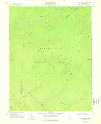
1967 Map of Webster Springs SE
USGS Topo · Published 1976About this map
The Monongahela National Forest dominates this mid-century survey of the high Allegheny plateau, where the Williams River and Cranberry River carve deep drainages through a landscape defined by timber and drainage networks. The map details a wilderness area transitioning into a managed recreational resource, evidenced by the Tumbling Rock Camping Shelter and various trails like the Red Black Trail.
Find a feature on this map
46 named features on this map. Tap any name to fly to it.
Don’t see what you’re looking for? This feature index may not catch every label — zoom into the map to look around manually.
Map Details
Editions of this 1967 Webster Springs SE Map
Other maps of this area

1891 · Huntersville
USGS Topo · 1:125,000

1894 · Huntersville
USGS Topo · 1:125,000

1915 · Webster Springs
USGS Topo · 1:48,000

1918 · Webster Springs
USGS Topo · 1:62,500

1923 · Lobelia
USGS Topo · 1:48,000

1923 · Marlinton
USGS Topo · 1:48,000

1923 · Mingo
USGS Topo · 1:48,000

1925 · Mingo
USGS Topo · 1:62,500

1925 · Marlinton
USGS Topo · 1:62,500

1925 · Lobelia
USGS Topo · 1:62,500