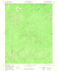
1967 Map of Webster Springs SE
USGS Topo · Published 1982About this map
Monongahela National Forest dominates this highland landscape, revealing a remote wilderness defined by the complex drainage of the Williams River. The terrain is marked by significant peaks such as Glade Mountain and Sugar Creek Mountain, where high-altitude ridges separate deep-cut stream valleys. The human footprint is sparse, represented by small backcountry features like the Tumbling Rock Camping Shelter and a solitary Drill Hole in the southern reaches. The map captures a transition between the elevated summits and the Little Levels plateau, with colorful local toponyms like Hell For Certain Branch and Hateful Run hinting at the challenging navigation of these woods in the late 1960s. Surveyed originally in 1966, the data provides a detailed record of the forest before subsequent decades of growth and conservation changed the undergrowth and access trails.
Find a feature on this map
48 named features on this map. Tap any name to fly to it.
Don’t see what you’re looking for? This feature index may not catch every label — zoom into the map to look around manually.
Map Details
Editions of this 1967 Webster Springs SE Map
Other maps of this area

1891 · Huntersville
USGS Topo · 1:125,000

1894 · Huntersville
USGS Topo · 1:125,000

1915 · Webster Springs
USGS Topo · 1:48,000

1918 · Webster Springs
USGS Topo · 1:62,500

1923 · Lobelia
USGS Topo · 1:48,000

1923 · Marlinton
USGS Topo · 1:48,000

1923 · Mingo
USGS Topo · 1:48,000

1925 · Mingo
USGS Topo · 1:62,500

1925 · Marlinton
USGS Topo · 1:62,500

1925 · Lobelia
USGS Topo · 1:62,500