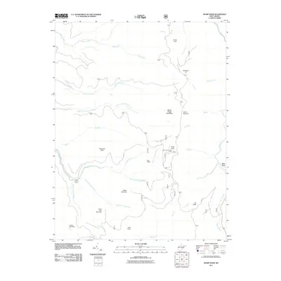
2011 Map of Sharp Knob
USGS Topo · Published 2011About this map
The high ridges of Gauley Mountain and Slabcamp Ridge define this high-altitude landscape where the headwaters of several major Appalachian drainages converge. In the southern portion of the quadrangle, the North Fork Gauley River, Middle Fork Gauley River, and South Fork Gauley River meet at the distinctive Three Forks of Gauley. The terrain is marked by numerous peaks and low passes, including Sharp Knob, which is crowned by the Sharps Knob Lookout Tower. While much of the area is undeveloped forest land, signs of human activity appear in the form of Mine Rd and the settlement of Slaty Fork on the eastern edge along the Elk River. The map meticulously tracks the complex network of mountain streams like Tea Creek and Bergoo Creek as they navigate between features such as Brush Camp Low Place and Turkey Mountain.
Find a feature on this map
33 named features on this map. Tap any name to fly to it.
Don’t see what you’re looking for? This feature index may not catch every label — zoom into the map to look around manually.
Map Details
Editions of this 2011 Sharp Knob Map
This is the sole edition of this map. No revisions or reprints were ever made.
Other maps of this area

1891 · Huntersville
USGS Topo · 1:125,000

1893 · Buckhannon
USGS Topo · 1:125,000

1894 · Huntersville
USGS Topo · 1:125,000

1896 · Buckhannon
USGS Topo · 1:125,000

1897 · Buckhannon
USGS Topo · 1:125,000

1913 · Hacker Valley
USGS Topo · 1:48,000

1913 · Pickens
USGS Topo · 1:48,000

1915 · Webster Springs
USGS Topo · 1:48,000

1915 · Hacker Valley
USGS Topo · 1:62,500

1915 · Pickens
USGS Topo · 1:62,500