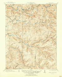
1918 Map of Webster Springs
USGS Topo · Published 1950About this map
Webster Springs (Addison) serves as the central hub of this 1915 survey, situated at the confluence of the Elk River and Back Fork. This mountain landscape is defined by its early 20th-century rural infrastructure, specifically a high density of neighborhood institutions like Kingfisher School, Excelsior School, and the St Marys School. The geography is dominated by long ridges and deep valleys, including Point Mountain and Buck Ridge, which hem in the river systems. Significant portions of the southeastern terrain fall within the Monongahela National Forest, illustrating the early conservation efforts in the West Virginia highlands. The map preserves the locations of local landmarks like Hanging Rock and several remote mountain schools, providing a clear view of the dispersed settlement patterns before modern road developments altered the interior access to these ridges.
Find a feature on this map
68 named features on this map. Tap any name to fly to it.
Don’t see what you’re looking for? This feature index may not catch every label — zoom into the map to look around manually.
Map Details
Editions of this 1918 Webster Springs Map
4 editions found

Other maps of this area

1889 · Nicholas
USGS Topo · 1:125,000

1891 · Nicholas
USGS Topo · 1:125,000

1891 · Huntersville
USGS Topo · 1:125,000

1893 · Buckhannon
USGS Topo · 1:125,000

1893 · Sutton
USGS Topo · 1:125,000

1894 · Huntersville
USGS Topo · 1:125,000

1896 · Buckhannon
USGS Topo · 1:125,000

1897 · Buckhannon
USGS Topo · 1:125,000

1901 · Nicholas
USGS Topo · 1:125,000

1908 · Sutton
USGS Topo · 1:48,000
Featured Places
- Addison (Webster Springs), WV
- Webster Springs, Addison (Webster Springs)
- Curtin, WV
- Skidmore Crossing, WV
- Bolair, WV