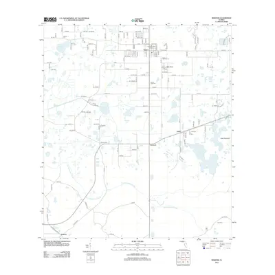
2012 Map of Webster
USGS Topo · Published 2012About this map
The Little Withlacoochee River winds through the southern reaches of this landscape, anchoring a region characterized by low-lying wetlands and scattered settlements. The city of Webster serves as a local hub, marked by its distinctive City of Webster Water Tower and Po (Post Office), while smaller communities like Linden, Tarrytown, and Oak Grove are linked by a network of county roads. The terrain is dotted with significant water bodies, including Big Gant Lake, Little Gant Lake, and Giddon Lake, interspersed with marshy features such as Marshall Bay and Cedar Hammock.
Find a feature on this map
140 named features on this map. Tap any name to fly to it.
Don’t see what you’re looking for? This feature index may not catch every label — zoom into the map to look around manually.
Map Details
Editions of this 2012 Webster Map
This is the sole edition of this map. No revisions or reprints were ever made.
Other maps of this area

1955 · Plant City
USGS Topo · 1:250,000

1955 · Orlando
USGS Topo · 1:250,000

1957 · Orlando
USGS Topo · 1:250,000

1958 · Orlando
USGS Topo · 1:250,000

1958 · Plant City
USGS Topo · 1:250,000

1958 · Webster
USGS Topo · 1:24,000

1958 · Bushnell
USGS Topo · 1:24,000

1958 · Wahoo
USGS Topo · 1:24,000

1958 · Saint Catherine
USGS Topo · 1:24,000

1959 · Plant City
USGS Topo · 1:250,000