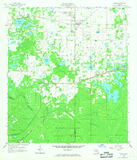
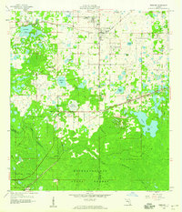
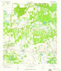
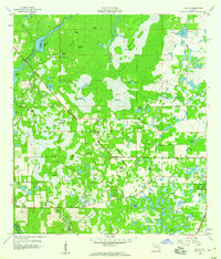
1958 Map of Webster
USGS Topo · Published 1987About this map
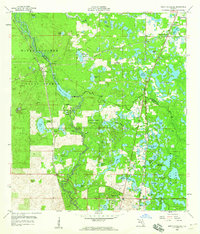
The Atlantic Coast Line railroad dictates the settlement pattern of this rural Sumter County landscape, connecting the town of Webster with the smaller communities of Linden and Tarrytown. The northern half of the sheet is a complex mosaic of marshland and named water bodies like Gant Lake and Big Gant Lake, while the southern portion is dominated by the dense canopy of the Withlacoochee State Forest.
Find a feature on this map
35 named features on this map. Tap any name to fly to it.
Don’t see what you’re looking for? This feature index may not catch every label — zoom into the map to look around manually.
Map Details
Editions of this 1958 Webster Map
2 editions found
Other maps of this area

1955 · Plant City
USGS Topo · 1:250,000

1955 · Orlando
USGS Topo · 1:250,000

1957 · Orlando
USGS Topo · 1:250,000

1958 · Orlando
USGS Topo · 1:250,000

1958 · Plant City
USGS Topo · 1:250,000
1958 · Webster
USGS Topo · 1:24,000
1958 · Bushnell
USGS Topo · 1:24,000
1958 · Wahoo
USGS Topo · 1:24,000
1958 · Saint Catherine
USGS Topo · 1:24,000

1959 · Plant City
USGS Topo · 1:250,000