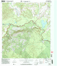
2004 Map of Weches
USGS Topo · Published 2006About this map
Mission Tejas State Park anchors the western portion of this East Texas landscape, where the mixed pine and hardwood canopies of the Davy Crockett National Forest meet the winding course of the Neches River. The terrain is defined by its diverse water features, ranging from the oxbow-rich river bottom containing Pearman Lake and Chain Of Lakes to the numerous smaller drainages like Boggy Creek and Box Creek.
Find a feature on this map
43 named features on this map. Tap any name to fly to it.
Don’t see what you’re looking for? This feature index may not catch every label — zoom into the map to look around manually.
Map Details
Editions of this 2004 Weches Map
This is the sole edition of this map. No revisions or reprints were ever made.
Other maps of this area

1946 · Alto
USGS Topo · 1:62,500

1950 · Crockett NE
USGS Topo · 1:24,000

1950 · Kennard NE
USGS Topo · 1:24,000

1950 · Ratcliff
USGS Topo · 1:24,000

1951 · Crockett NE
USGS Topo · 1:24,000

1951 · Kennard NE
USGS Topo · 1:24,000

1951 · Ratcliff
USGS Topo · 1:24,000

1952 · Slocum
USGS Topo · 1:62,500

1953 · Palestine
USGS Topo · 1:250,000

1957 · Palestine
USGS Topo · 1:250,000