
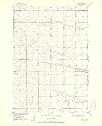
1952 Map of Wecota
USGS Topo · Published 1952About this map
Wecota anchors this 1952 topographic study, situated along the edge of an Old Railroad Grade that speaks to the shifting transportation priorities of mid-century South Dakota. The landscape is characterized by its organized rural infrastructure, featuring a network of township boundaries including Freedom, Emerson, and Pulaski. These townships supported a dense system of local schools, such as North Freedom Sch and Kellett Sch, reflecting a time when educational hubs were distributed to serve farming families within walking or short driving distance.
Find a feature on this map
15 named features on this map. Tap any name to fly to it.
Don’t see what you’re looking for? This feature index may not catch every label — zoom into the map to look around manually.
Map Details
Editions of this 1952 Wecota Map
2 editions found
Other maps of this area

1899 · Northville
USGS Topo · 1:125,000

1952 · Norbeck
USGS Topo · 1:24,000

1952 · Faulkton West
USGS Topo · 1:24,000

1952 · Faulkton East
USGS Topo · 1:24,000

1954 · Aberdeen
USGS Topo · 1:250,000

1956 · Aberdeen
USGS Topo · 1:250,000
1966 · Cresbard SW
USGS Topo · 1:24,000

1966 · Cresbard
USGS Topo · 1:24,000

1970 · Mina SW
USGS Topo · 1:24,000
1974 · Ipswich SE
USGS Topo · 1:24,000