2024 Map of Wedowee
USGS Topo · Published 2024About this map
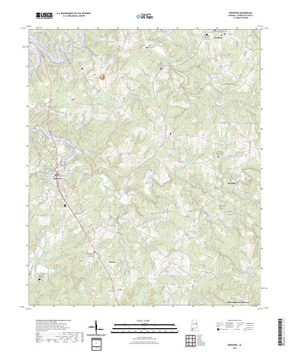
Wedowee and the surrounding Randolph County countryside are defined by the winding course of the Little Tallapoosa River and numerous creek systems. This modern survey reflects the enduring character of East Alabama, where small settlements like Woodland, Haywood, and Tennant are connected by a network of county roads. The landscape is punctuated by several significant rural burial grounds and places of worship, including the Midway United Methodist Church Cem and Liberty Grove Church Cem.
Find a feature on this map
141 named features on this map. Tap any name to fly to it.
Don’t see what you’re looking for? This feature index may not catch every label — zoom into the map to look around manually.
Map Details
Editions of this 2024 Wedowee Map
This is the sole edition of this map. No revisions or reprints were ever made.
Historical Maps of Ava Through Time
4 maps found