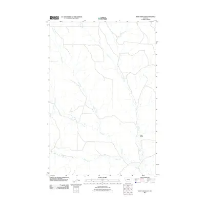
2011 Map of Weed Creek East
USGS Topo · Published 2011About this map
Stove Coulee sits at the heart of this dry-country drainage system in Yellowstone County, where a network of seasonal watercourses defines the open Montana landscape. The hydrology is dominated by the winding paths of Indian Creek and Injun Creek, which converge from the north and west. Further south, the terrain is shaped by the confluence of Alkali Creek and Weed Creek, creating a complex web of draws and coulees typical of the region's high plains topography. Sparse road development follows the natural contours of the land, illustrating the vast, unpopulated character of this ranchland area in the early 21st century.
Find a feature on this map
6 named features on this map. Tap any name to fly to it.
Don’t see what you’re looking for? This feature index may not catch every label — zoom into the map to look around manually.
Map Details
Editions of this 2011 Weed Creek East Map
This is the sole edition of this map. No revisions or reprints were ever made.
Other maps of this area

1954 · Forsyth
USGS Topo · 1:250,000

1957 · Forsyth
USGS Topo · 1:250,000

1958 · Forsyth
USGS Topo · 1:250,000

1962 · Guthridge Ranch
USGS Topo · 1:24,000

1962 · Sumatra
USGS Topo · 1:24,000

1963 · Melstone
USGS Topo · 1:24,000

1979 · Melstone
USGS Topo · 1:100,000

1979 · Hysham
USGS Topo · 1:100,000
1979 · Devils Kitchen
USGS Topo · 1:24,000
1980 · Weed Creek West
USGS Topo · 1:24,000