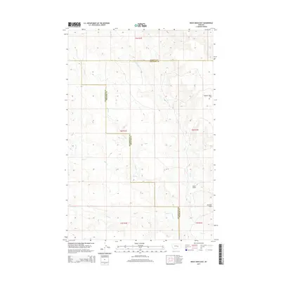
2014 Map of Weed Creek East
USGS Topo · Published 2014About this map
Muggins Taylor Flat dominates the northeastern corner of this landscape, situated near the intersection of the Rosebud, Treasure, and Yellowstone county lines. This drainage basin is defined by a network of seasonal watercourses, including the westward-flowing Indian Cr and the southerly Injun Cr, which carve through the high plains. The topography reveals a series of prominent landforms like Stove Coulee and Ruskosky Ridge, illustrating the erosional patterns of the Montana prairie. Land management and historical property divisions are clearly visible through the section lines of the Public Land Survey System, covering townships T7N through T9N. The map provides a detailed view of the remote drainage systems of Alkali Cr and Weed Cr as they appeared in the early 21st century.
Find a feature on this map
15 named features on this map. Tap any name to fly to it.
Don’t see what you’re looking for? This feature index may not catch every label — zoom into the map to look around manually.
Map Details
Editions of this 2014 Weed Creek East Map
This is the sole edition of this map. No revisions or reprints were ever made.
Other maps of this area

1954 · Forsyth
USGS Topo · 1:250,000

1957 · Forsyth
USGS Topo · 1:250,000

1958 · Forsyth
USGS Topo · 1:250,000

1962 · Guthridge Ranch
USGS Topo · 1:24,000

1962 · Sumatra
USGS Topo · 1:24,000

1963 · Melstone
USGS Topo · 1:24,000

1979 · Melstone
USGS Topo · 1:100,000

1979 · Hysham
USGS Topo · 1:100,000
1979 · Devils Kitchen
USGS Topo · 1:24,000
1980 · Weed Creek West
USGS Topo · 1:24,000