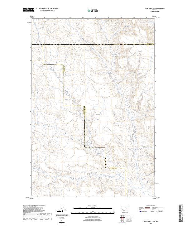
2024 Map of Weed Creek East
USGS Topo · Published 2024About this map
The vast drainage network of the Yellowstone and Treasure County borderlands is defined by a series of intermittent watercourses, including Indian Creek and Injun Creek which flow through the north-central plateaus. This 2024 landscape reveals the intersection of three counties, with the Rosebud Co Treasure Co line meeting the Yellowstone Co Treasure Co boundary in a series of surveyed sections. The terrain is marked by distinctive geological features like Stove Coulee, where the drainage patterns suggest a complex erosional history typical of this Montana region.
Find a feature on this map
16 named features on this map. Tap any name to fly to it.
Don’t see what you’re looking for? This feature index may not catch every label — zoom into the map to look around manually.
Map Details
Editions of this 2024 Weed Creek East Map
This is the sole edition of this map. No revisions or reprints were ever made.
Other maps of this area

1954 · Forsyth
USGS Topo · 1:250,000

1957 · Forsyth
USGS Topo · 1:250,000

1958 · Forsyth
USGS Topo · 1:250,000

1962 · Guthridge Ranch
USGS Topo · 1:24,000

1962 · Sumatra
USGS Topo · 1:24,000

1963 · Melstone
USGS Topo · 1:24,000

1979 · Melstone
USGS Topo · 1:100,000

1979 · Hysham
USGS Topo · 1:100,000
1979 · Devils Kitchen
USGS Topo · 1:24,000
1980 · Weed Creek West
USGS Topo · 1:24,000