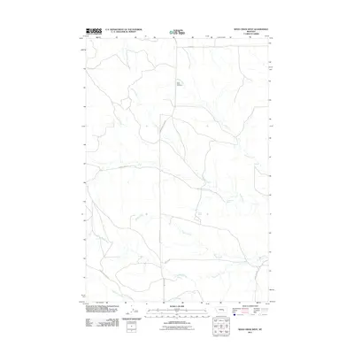
2011 Map of Weed Creek West
USGS Topo · Published 2011About this map
Cabin Creek Cemetery sits near the northern reaches of this Yellowstone County landscape, marking a quiet point of reference in an area defined by its seasonal drainages and spring-fed hydrology. The terrain is crisscrossed by several prominent waterways, including Alkali Creek, Cabin Creek, and Weed Creek, which carve winding paths through the territory. These water sources were vital for early ranching and travel, supplemented by specific points like Rock Spring and Lemonade Spring.
Find a feature on this map
15 named features on this map. Tap any name to fly to it.
Don’t see what you’re looking for? This feature index may not catch every label — zoom into the map to look around manually.
Map Details
Editions of this 2011 Weed Creek West Map
This is the sole edition of this map. No revisions or reprints were ever made.
Other maps of this area

1954 · Forsyth
USGS Topo · 1:250,000

1957 · Forsyth
USGS Topo · 1:250,000

1958 · Forsyth
USGS Topo · 1:250,000

1962 · Queens Point
USGS Topo · 1:24,000

1962 · Guthridge Ranch
USGS Topo · 1:24,000

1963 · Melstone
USGS Topo · 1:24,000

1979 · Melstone
USGS Topo · 1:100,000

1979 · Hysham
USGS Topo · 1:100,000
1980 · Weed Creek West
USGS Topo · 1:24,000
1980 · Weed Creek East
USGS Topo · 1:24,000