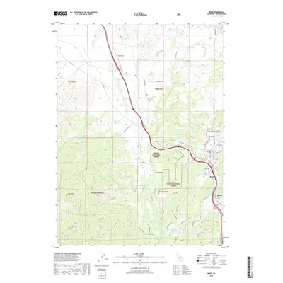
2018 Map of Weed
USGS Topo · Published 2018About this map
Shasta National Forest dominates the southern and western reaches of this landscape, where the terrain transitions into the high Shasta Valley. The community of Weed serves as the primary hub, situated near the College of the Siskiyous and the junction of major transportation corridors including S Weed Blvd and the historic route of Old Hwy 99. To the north, the settlement of Edgewood is positioned along the Shasta River, surrounded by a network of ranch roads and water features like Beaughton Cr and Carrick Cr.
Find a feature on this map
82 named features on this map. Tap any name to fly to it.
Don’t see what you’re looking for? This feature index may not catch every label — zoom into the map to look around manually.
Map Details
Editions of this 2018 Weed Map
This is the sole edition of this map. No revisions or reprints were ever made.
Other maps of this area

1886 · Shasta
USGS Topo · 1:250,000

1894 · Shasta
USGS Topo · 1:250,000

1921 · Shasta Valley Sheet No 7
USGS Topo · 1:24,000

1921 · Shasta Valley Sheet No 1
USGS Topo · 1:24,000

1922 · Shasta Valley Sheet No 10
USGS Topo · 1:24,000

1922 · Shasta Valley Sheet No 1 S
USGS Topo · 1:24,000

1922 · Shasta Valley Sheet No 9
USGS Topo · 1:24,000
1922 · Shasta Valley Sheet No 8
USGS Topo · 1:24,000

1923 · Sawyers Bar
USGS Topo · 1:125,000

1931 · Etna
USGS Topo · 1:96,000