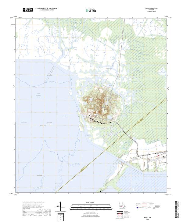
2024 Map of Weeks
USGS Topo · Published 2024About this map
Weeks Island rises as a prominent landmark in the marshy landscape of coastal Louisiana, anchoring this 2024 survey of the Iberia and St. Mary Parish border. The settlement of Weeks and the industrial infrastructure along Advanced Materials Dr and Morton Rd reveal the specialized salt dome mining and storage operations that have long defined this geography. Waterways dominate the terrain, from the sprawling Vermilion Bay and Weeks Bay to the vital transportation artery of the Intracoastal Waterway.
Find a feature on this map
40 named features on this map. Tap any name to fly to it.
Don’t see what you’re looking for? This feature index may not catch every label — zoom into the map to look around manually.
Map Details
Editions of this 2024 Weeks Map
This is the sole edition of this map. No revisions or reprints were ever made.
Other maps of this area

1937 · Bayou Sale
USGS Topo · 1:62,500

1937 · Jeanerette
USGS Topo · 1:62,500

1937 · Derouen
USGS Topo · 1:62,500

1945 · New Orleans
USGS Topo · 1:250,000

1948 · Cypremort Point
USGS Topo · 1:24,000

1949 · Cypremort Pt
USGS Topo · 1:31,680

1954 · Jeanerette
USGS Topo · 1:62,500

1957 · Bayou Sale
USGS Topo · 1:62,500

1963 · New Orleans
USGS Topo · 1:250,000
1963 · Weeks
USGS Topo · 1:24,000