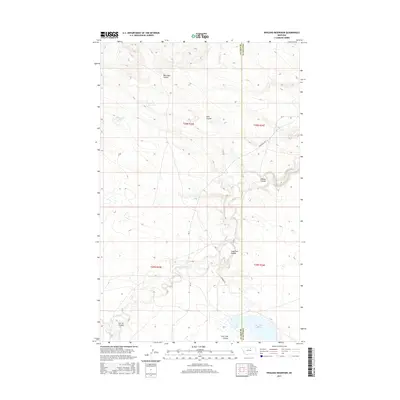
2017 Map of Weigand Reservoir
USGS Topo · Published 2017About this map
Peoples Cr meanders through the central expanse of this 2017 landscape, defining a network of drainage patterns across the boundary of Blaine and Phillips counties. The terrain is characterized by numerous seasonal watercourses and topographic depressions, including the prominent Weigand Reservoir and the more isolated Old Woman Lake. The survey details a series of named geographical features known as coulees, such as Box Elder Coulee, Kuhr Coulee, and Lone Tree Coulee, which illustrate the erosion-carved character of this Montana high-plains environment. Road access is primarily provided by Rte 8 and the Lodgepole Hwy, which cross the township and range lines of t30n r25e and t29n r26e. The map offers a precise look at the hydrology and ranch-land infrastructure, including family or landmark-named sites like Corral Coulee and Willow Coulee.
Find a feature on this map
17 named features on this map. Tap any name to fly to it.
Don’t see what you’re looking for? This feature index may not catch every label — zoom into the map to look around manually.
Map Details
Editions of this 2017 Weigand Reservoir Map
This is the sole edition of this map. No revisions or reprints were ever made.
Other maps of this area

1953 · Havre
USGS Topo · 1:250,000

1957 · Havre
USGS Topo · 1:250,000

1958 · Havre
USGS Topo · 1:250,000

1964 · Coburg
USGS Topo · 1:24,000

1964 · Coburg SE
USGS Topo · 1:24,000
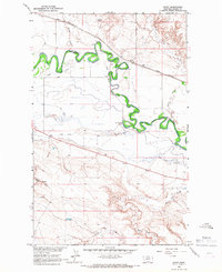
1964 · Savoy
USGS Topo · 1:24,000

1964 · Weigand Reservoir
USGS Topo · 1:24,000

1964 · Dodson Dam
USGS Topo · 1:24,000

1971 · Big Flat East
USGS Topo · 1:24,000

1971 · Lodge Pole NE
USGS Topo · 1:24,000