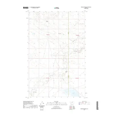
2020 Map of Weigand Reservoir
USGS Topo · Published 2020About this map
Peoples Cr meanders across this Montana landscape, cutting through a series of distinct drainage patterns including Box Elder Coulee, Kuhr Coulee, and Lone Tree Coulee. The terrain is characterized by these intermittent watercourses and natural basins like Old Woman Lake in the northwest. Human infrastructure is primarily represented by a sparse network of roads, including Lodgepole Hwy and Wiegand Rd, which navigate the boundary between Blaine and Phillips Counties. The southern portion of the quadrangle is dominated by the Weigand Reservoir, a significant water feature that anchors the local hydrography and supports the surrounding rangeland. The map detail reflects the expansive, open character of the Agency District, where the land is shaped by seasonal moisture and long-established township lines.
Find a feature on this map
16 named features on this map. Tap any name to fly to it.
Don’t see what you’re looking for? This feature index may not catch every label — zoom into the map to look around manually.
Map Details
Editions of this 2020 Weigand Reservoir Map
This is the sole edition of this map. No revisions or reprints were ever made.
Other maps of this area

1953 · Havre
USGS Topo · 1:250,000

1957 · Havre
USGS Topo · 1:250,000

1958 · Havre
USGS Topo · 1:250,000

1964 · Coburg
USGS Topo · 1:24,000

1964 · Coburg SE
USGS Topo · 1:24,000
1964 · Savoy
USGS Topo · 1:24,000

1964 · Weigand Reservoir
USGS Topo · 1:24,000

1964 · Dodson Dam
USGS Topo · 1:24,000

1971 · Big Flat East
USGS Topo · 1:24,000

1971 · Lodge Pole NE
USGS Topo · 1:24,000