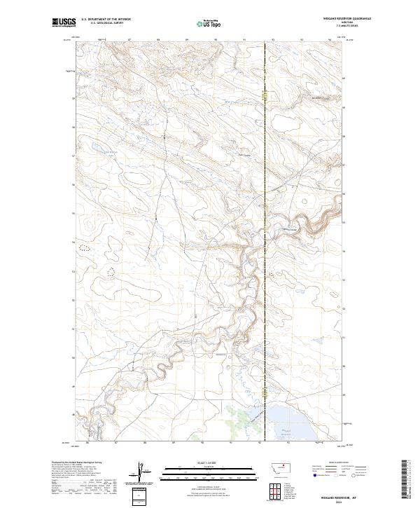
2024 Map of Weigand Reservoir
USGS Topo · Published 2024About this map
Peoples Creek meanders deeply through the center of this northern Montana landscape, its winding course defining the geography of the border between Blaine and Phillips Counties. The terrain is marked by a series of significant drainage features including Box Elder Coulee, Kuhr Coulee, and Willow Coulee, which cut through the high plains toward the central creek bed. This modern mapping reflects a sparsely settled ranching or conservation area where water is the primary landmark, anchored by Weigand Reservoir in the south and the seasonal Old Woman Lake to the northwest. The intersection of Lodgepole Hwy and Rte 8 provides the primary transit through these townships, while Wiegand Rd offers access to the reservoir. The map preserves the specific cattle-country nomenclature of the region, emphasizing the importance of natural water catchments and coulees in this arid environment.
Find a feature on this map
16 named features on this map. Tap any name to fly to it.
Don’t see what you’re looking for? This feature index may not catch every label — zoom into the map to look around manually.
Map Details
Editions of this 2024 Weigand Reservoir Map
This is the sole edition of this map. No revisions or reprints were ever made.
Other maps of this area

1953 · Havre
USGS Topo · 1:250,000

1957 · Havre
USGS Topo · 1:250,000

1958 · Havre
USGS Topo · 1:250,000

1964 · Coburg
USGS Topo · 1:24,000

1964 · Coburg SE
USGS Topo · 1:24,000
1964 · Savoy
USGS Topo · 1:24,000

1964 · Weigand Reservoir
USGS Topo · 1:24,000

1964 · Dodson Dam
USGS Topo · 1:24,000

1971 · Big Flat East
USGS Topo · 1:24,000

1971 · Lodge Pole NE
USGS Topo · 1:24,000