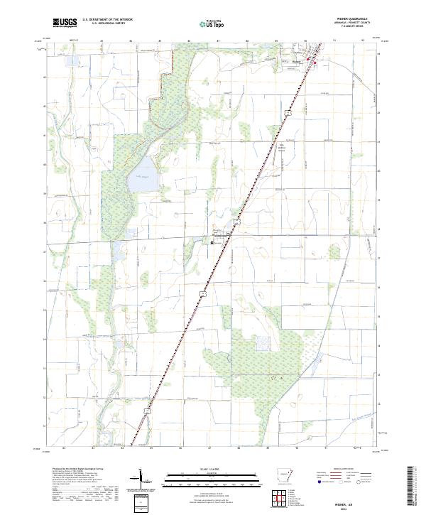
2024 Map of Weiner
USGS Topo · Published 2024About this map
Bayou De View meanders through the lowlands of Poinsett County, defining a landscape of agricultural drainage and managed wetlands. The settlement of Weiner occupies the northern reaches of the quadrangle, while Waldenburg sits further south near the intersection of several local routes. These communities serve as hubs for a region shaped by water management features like the Flag Slough Ditch and Lake Hogue. The map documents a fine network of rural roads such as Ukena Rd and Wolf Den Rd that navigate the flat terrain between waterways. Genealogists and local researchers will find markers of the area's social fabric, including Zion Cem near Waldenburg and the Sally Wofford Airport, which supports the aerial needs of this delta landscape.
Find a feature on this map
69 named features on this map. Tap any name to fly to it.
Don’t see what you’re looking for? This feature index may not catch every label — zoom into the map to look around manually.
Map Details
Editions of this 2024 Weiner Map
This is the sole edition of this map. No revisions or reprints were ever made.
Other maps of this area

1935 · Tuckerman
USGS Topo · 1:62,500

1939 · Vanndale
USGS Topo · 1:62,500

1939 · Weiner
USGS Topo · 1:62,500

1940 · Tilton
USGS Topo · 1:62,500

1953 · Memphis
USGS Topo · 1:250,000

1956 · Memphis
USGS Topo · 1:250,000

1956 · Tilton
USGS Topo · 1:62,500

1958 · Vanndale
USGS Topo · 1:62,500

1959 · Weiner
USGS Topo · 1:62,500

1960 · Weiner
USGS Topo · 1:62,500