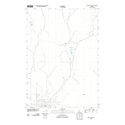
2010 Map of Weiser North
USGS Topo · Published 2010About this map
Weiser serves as the focal point of this northern Idaho landscape, situated where the residential grid meets a complex network of agricultural irrigation and water management. The irrigation infrastructure is particularly prominent, featuring the Galloway Canal and several significant impoundments including Jenkins Creek Reservoir and Barton Reservoir. These water sources are fed by a series of drainages such as Monroe Creek and Sheep Creek, which flow through a topography marked by distinctive landforms like Sagebrush Hill and the sharp bend known as Devils Elbow.
Find a feature on this map
27 named features on this map. Tap any name to fly to it.
Don’t see what you’re looking for? This feature index may not catch every label — zoom into the map to look around manually.
Map Details
Editions of this 2010 Weiser North Map
This is the sole edition of this map. No revisions or reprints were ever made.
Other maps of this area

1897 · Weiser
USGS Topo · 1:125,000

1951 · Moores Hollow
USGS Topo · 1:24,000

1951 · Moores Hollow
USGS Topo · 1:62,500

1951 · Weiser South
USGS Topo · 1:24,000

1952 · Weiser Cove
USGS Topo · 1:24,000

1952 · Olds Ferry
USGS Topo · 1:62,500

1952 · Olds Ferry SE
USGS Topo · 1:24,000

1953 · Mann Creek
USGS Topo · 1:62,500

1955 · Baker
USGS Topo · 1:250,000

1959 · Baker
USGS Topo · 1:250,000