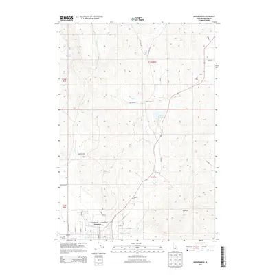
2013 Map of Weiser North
USGS Topo · Published 2013About this map
The city of Weiser sits at the southern edge of this Idaho-Washington borderland, where the residential streets transition into a network of irrigation works and mountain drainages. Critical water management infrastructure like the Galloway Canal and reservoirs such as Barton Reservoir and Jenkins Cr Reservoir support the local agricultural landscape. The terrain rises sharply away from the valley floor toward landmarks like Sagebrush Hill and the winding Devils Elbow along the hills. Rural access is defined by numerous named tracks, including Chicken Creek Rd and Olds Ferry Rd, which connect remote ranching sites and the Jenkins Creek Ranch Airport to the main settlement. Small locales like Gentry appear along the road network, marking the early 21st-century footprint of this rugged region where Monroe Cr and Jenkins Cr carve through the high ground.
Find a feature on this map
45 named features on this map. Tap any name to fly to it.
Don’t see what you’re looking for? This feature index may not catch every label — zoom into the map to look around manually.
Map Details
Editions of this 2013 Weiser North Map
This is the sole edition of this map. No revisions or reprints were ever made.
Other maps of this area

1897 · Weiser
USGS Topo · 1:125,000

1951 · Moores Hollow
USGS Topo · 1:24,000

1951 · Moores Hollow
USGS Topo · 1:62,500

1951 · Weiser South
USGS Topo · 1:24,000

1952 · Weiser Cove
USGS Topo · 1:24,000

1952 · Olds Ferry
USGS Topo · 1:62,500

1952 · Olds Ferry SE
USGS Topo · 1:24,000

1953 · Mann Creek
USGS Topo · 1:62,500

1955 · Baker
USGS Topo · 1:250,000

1959 · Baker
USGS Topo · 1:250,000