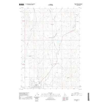
2020 Map of Weiser North
USGS Topo · Published 2020About this map
Weiser anchors the southern edge of this Idaho landscape, where the northern residential streets give way to a network of irrigation and drainage that supports the local agricultural economy. The Galloway Canal serves as a vital hydrological artery, while a series of creeks including Monroe Cr, Jenkins Cr, and Sheep Cr drain the higher elevations to the north. This modern survey reflects the rural character of Washington County, showing the transition from the city grid to the winding paths of Chicken Creek Rd and Monroe Creek Rd.
Find a feature on this map
37 named features on this map. Tap any name to fly to it.
Don’t see what you’re looking for? This feature index may not catch every label — zoom into the map to look around manually.
Map Details
Editions of this 2020 Weiser North Map
This is the sole edition of this map. No revisions or reprints were ever made.
Other maps of this area

1897 · Weiser
USGS Topo · 1:125,000

1951 · Moores Hollow
USGS Topo · 1:24,000

1951 · Moores Hollow
USGS Topo · 1:62,500

1951 · Weiser South
USGS Topo · 1:24,000

1952 · Weiser Cove
USGS Topo · 1:24,000

1952 · Olds Ferry
USGS Topo · 1:62,500

1952 · Olds Ferry SE
USGS Topo · 1:24,000

1953 · Mann Creek
USGS Topo · 1:62,500

1955 · Baker
USGS Topo · 1:250,000

1959 · Baker
USGS Topo · 1:250,000