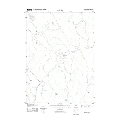
2012 Map of Weiser Pass
USGS Topo · Published 2012About this map
The Dallas Oil Field and Derby Dome Oil Field define the industrial footprint of this Fremont County landscape, where energy extraction meets traditional high-plains ranching. The terrain is marked by significant topographical shifts, moving from the depths of Devils Canyon up to the Cottonwood Divide. Water remains the critical resource for the area's remote homesteads, with named sources like Commissary Spring, Pipe Springs, and Barrel Spring supporting livestock and human habitation.
Find a feature on this map
38 named features on this map. Tap any name to fly to it.
Don’t see what you’re looking for? This feature index may not catch every label — zoom into the map to look around manually.
Map Details
Editions of this 2012 Weiser Pass Map
This is the sole edition of this map. No revisions or reprints were ever made.
Other maps of this area

1952 · Lander SE
USGS Topo · 1:24,000

1952 · Lander
USGS Topo · 1:24,000

1953 · Ninemile Hill
USGS Topo · 1:24,000

1953 · Gravel Spring
USGS Topo · 1:24,000

1953 · Schlichting Mountain
USGS Topo · 1:24,000

1953 · Del Monte Ridge
USGS Topo · 1:24,000

1953 · Weiser Pass
USGS Topo · 1:24,000

1954 · Wolf Point
USGS Topo · 1:24,000

1954 · Miners Delight
USGS Topo · 1:24,000

1955 · Lander
USGS Topo · 1:250,000