
1954 Map of Wolf Point
USGS Topo · Published 1956About this map
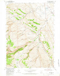
The Little Popo Agie River carves a dramatic path through the landscape of central Wyoming, defining the transition from high mountain slopes to the rugged drainages of Red Canyon Rim. This 1954 survey shows a sparsely settled ranching region where civic life was anchored by remote rural institutions, including the Lower Willow Creek Sch, Upper Willow Creek Sch, and Madison Creek Sch. The map documents the early infrastructure of the Missouri River Basin development program, recording family holdings like the Whitehead Ranch and the Wilkinson Sheep Sheds that dotted the draws and canyons.
Find a feature on this map
38 named features on this map. Tap any name to fly to it.
Don’t see what you’re looking for? This feature index may not catch every label — zoom into the map to look around manually.
Map Details
Editions of this 1954 Wolf Point Map
3 editions found
Other maps of this area

1952 · Lander SE
USGS Topo · 1:24,000

1952 · Lander
USGS Topo · 1:24,000

1953 · Gravel Spring
USGS Topo · 1:24,000

1953 · Fossil Hill
USGS Topo · 1:24,000

1953 · Louis Lake
USGS Topo · 1:24,000

1953 · Weiser Pass
USGS Topo · 1:24,000

1953 · Mount Arter SE
USGS Topo · 1:24,000

1954 · Miners Delight
USGS Topo · 1:24,000

1955 · Lander
USGS Topo · 1:250,000

1958 · Lander
USGS Topo · 1:250,000