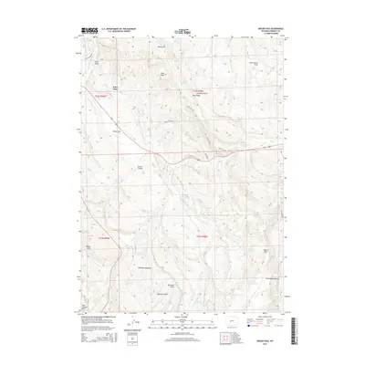
2015 Map of Weiser Pass
USGS Topo · Published 2015About this map
Kotey Place and the scattered clearings of Onion Flats anchor this Fremont County landscape, where the high desert meets the drainages of the Little Popo Agie River. The terrain is defined by a series of significant ridges and divides, most notably Cottonwood Divide and the Red Canyon Rim in the south. The area's hydrology is marked by numerous springs such as Coal Mine Spring and Critnan Springs, which feed a network of creeks including Weiser Cr and Twin Cr.
Find a feature on this map
43 named features on this map. Tap any name to fly to it.
Don’t see what you’re looking for? This feature index may not catch every label — zoom into the map to look around manually.
Map Details
Editions of this 2015 Weiser Pass Map
This is the sole edition of this map. No revisions or reprints were ever made.
Other maps of this area

1952 · Lander SE
USGS Topo · 1:24,000

1952 · Lander
USGS Topo · 1:24,000

1953 · Ninemile Hill
USGS Topo · 1:24,000

1953 · Gravel Spring
USGS Topo · 1:24,000

1953 · Schlichting Mountain
USGS Topo · 1:24,000

1953 · Del Monte Ridge
USGS Topo · 1:24,000

1953 · Weiser Pass
USGS Topo · 1:24,000

1954 · Wolf Point
USGS Topo · 1:24,000

1954 · Miners Delight
USGS Topo · 1:24,000

1955 · Lander
USGS Topo · 1:250,000