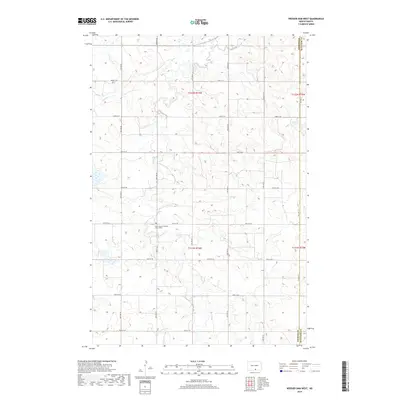
2018 Map of Weisser Dam West
USGS Topo · Published 2018About this map
Saint Aloysius Catholic Church and its accompanying Saint Aloysius Catholic Church Cem serve as a central cultural landmark for this rural portion of Emmons and McIntosh Counties. The landscape is defined by the winding paths of Beaver Cr and the S Br Beaver Cr, which traverse a terrain marked by numerous prairie potholes and wetlands characteristic of the North Dakota plains. A strictly organized grid of section-line roads, including 81st St SE through 89th St SE, dictates the movement across the agricultural countryside. In the northeast, the impounded waters of Weisser Dam suggest the importance of local water management in this high-plains environment during the early 21st century.
Find a feature on this map
19 named features on this map. Tap any name to fly to it.
Don’t see what you’re looking for? This feature index may not catch every label — zoom into the map to look around manually.
Map Details
Editions of this 2018 Weisser Dam West Map
This is the sole edition of this map. No revisions or reprints were ever made.
Other maps of this area

1953 · Jamestown
USGS Topo · 1:250,000

1954 · Bismarck
USGS Topo · 1:250,000

1956 · Jamestown
USGS Topo · 1:250,000

1958 · Bismarck
USGS Topo · 1:250,000

1979 · Schell Buttes
USGS Topo · 1:24,000

1979 · Senger Lake North
USGS Topo · 1:24,000
1979 · Senger Lake South
USGS Topo · 1:24,000

1979 · Schell Buttes SW
USGS Topo · 1:24,000
1980 · Rohrich Dam
USGS Topo · 1:24,000
1980 · Linton
USGS Topo · 1:100,000