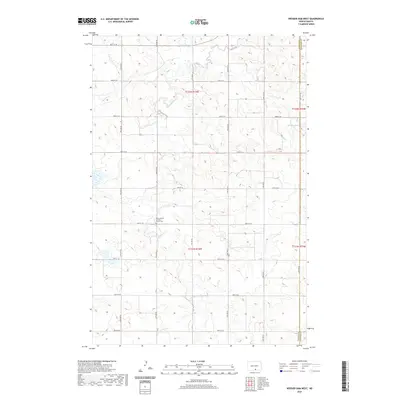
2020 Map of Weisser Dam West
USGS Topo · Published 2020About this map
Saint Aloysius Catholic Church Cem serves as a primary historical anchor in this sparsely populated region of North Dakota. The landscape is defined by the winding course of Beaver Cr and its tributary, S Br Beaver Cr, which carve through the undulating prairie. Human activity is evidenced by a precise grid of sectional roads, including 81st St SE and 89th St SE, which facilitate travel between isolated farmsteads and agricultural plots. Near the eastern boundary of McIntosh County, the Weisser Dam represents a critical piece of water management infrastructure in this rural environment. This map highlights the intersection of religious tradition and geographic necessity, where the local cemetery and church site stand as one of the few named landmarks amidst the vast sections of the Public Land Survey System.
Find a feature on this map
19 named features on this map. Tap any name to fly to it.
Don’t see what you’re looking for? This feature index may not catch every label — zoom into the map to look around manually.
Map Details
Editions of this 2020 Weisser Dam West Map
This is the sole edition of this map. No revisions or reprints were ever made.
Other maps of this area

1953 · Jamestown
USGS Topo · 1:250,000

1954 · Bismarck
USGS Topo · 1:250,000

1956 · Jamestown
USGS Topo · 1:250,000

1958 · Bismarck
USGS Topo · 1:250,000

1979 · Schell Buttes
USGS Topo · 1:24,000

1979 · Senger Lake North
USGS Topo · 1:24,000
1979 · Senger Lake South
USGS Topo · 1:24,000

1979 · Schell Buttes SW
USGS Topo · 1:24,000
1980 · Rohrich Dam
USGS Topo · 1:24,000
1980 · Linton
USGS Topo · 1:100,000