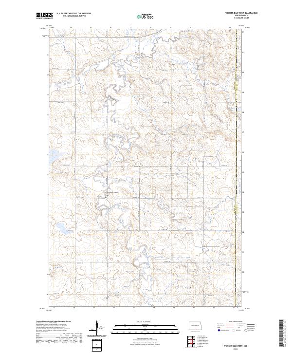
2024 Map of Weisser Dam West
USGS Topo · Published 2024About this map
Saint Aloysius Catholic Church stands as a focal point for the rural community in this portion of Emmons County and McIntosh County, accompanied by a local Cem. The landscape is defined by the winding course of Beaver Creek and the South Branch Beaver Creek, which drain the undulating terrain of south-central North Dakota. The mapping reveals a strictly organized section-line road grid, including 19th Ave SE and 84th St SE, which facilitates travel between isolated farmsteads and agricultural plots. Near the eastern boundary, the namesake Weisser Dam represents the local water management efforts common in this prairie region, where seasonal creek flows are harnessed for livestock and land use.
Find a feature on this map
25 named features on this map. Tap any name to fly to it.
Don’t see what you’re looking for? This feature index may not catch every label — zoom into the map to look around manually.
Map Details
Editions of this 2024 Weisser Dam West Map
This is the sole edition of this map. No revisions or reprints were ever made.
Other maps of this area

1953 · Jamestown
USGS Topo · 1:250,000

1954 · Bismarck
USGS Topo · 1:250,000

1956 · Jamestown
USGS Topo · 1:250,000

1958 · Bismarck
USGS Topo · 1:250,000

1979 · Schell Buttes
USGS Topo · 1:24,000

1979 · Senger Lake North
USGS Topo · 1:24,000
1979 · Senger Lake South
USGS Topo · 1:24,000

1979 · Schell Buttes SW
USGS Topo · 1:24,000
1980 · Rohrich Dam
USGS Topo · 1:24,000
1980 · Linton
USGS Topo · 1:100,000