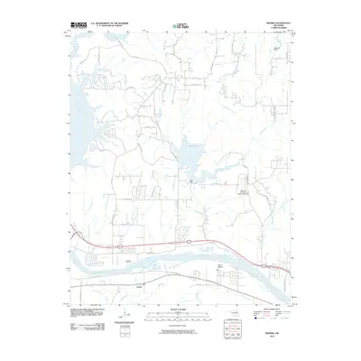
2010 Map of Wekiwa
USGS Topo · Published 2010About this map
Arkansas River riparian landscapes and the small settlement of Lotsee define this region west of Tulsa during the early 21st century. The terrain is marked by a complex network of drainage systems, including Fisher Creek, Euchee Creek, and Shell Creek, the latter of which is impounded by the Shell Dam to form Shell Lake. This area serves as a transition between the river lowlands at Fisher Bottom and the upland residential and aviation corridors. Aviation history is particularly visible through the presence of the William R Pogue Municipal Airport and the smaller Double W Airport. The road network, including Wekiwa Rd and Old State Hwy 51, illustrates the connectivity between rural homesteads and the growing suburban outskirts, while features like Phillips Lake and numerous smaller creeks highlight the local water management essential to the county's development.
Find a feature on this map
43 named features on this map. Tap any name to fly to it.
Don’t see what you’re looking for? This feature index may not catch every label — zoom into the map to look around manually.
Map Details
Editions of this 2010 Wekiwa Map
This is the sole edition of this map. No revisions or reprints were ever made.
Other maps of this area

1912 · Hominy
USGS Topo · 1:125,000

1915 · Hominy
USGS Topo · 1:125,000

1915 · Hominy
USGS Topo · 1:62,500

1955 · Enid
USGS Topo · 1:250,000

1956 · Sand Springs
USGS Topo · 1:24,000

1956 · Sapulpa North
USGS Topo · 1:24,000

1958 · Enid
USGS Topo · 1:250,000

1958 · Keystone Dam
USGS Topo · 1:24,000
1958 · Mannford SE
USGS Topo · 1:24,000

1958 · Wekiwa
USGS Topo · 1:24,000