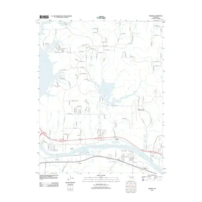
2012 Map of Wekiwa
USGS Topo · Published 2012About this map
The Arkansas River carves a wide course through this landscape, defining the local geography around the settlements of Wekiwa, Lotsee, and Fisher. This 2012 survey illustrates the transition from the riparian lowlands of Fisher Bottom to the more elevated residential developments and transit corridors. The influence of regional aviation is evident with both the William R. Pogue Municipal Airport and the Double W Airport situated within the quadrangle. Several significant water bodies shape the northern and central portions of the map, including the eastern reaches of Key Stone Lake, Shell Lake, and Phillips Lake. The road network reflects a mix of traditional section lines and newer developments, with names like Seminole Pass, Cheyenne Rd, and N Pawnee Rd hinting at the area's heritage. To the north, Osage Pass provides a notable topographical landmark overlooking the surrounding drainage basins of Delaware Cr and Shell Cr.
Find a feature on this map
139 named features on this map. Tap any name to fly to it.
Don’t see what you’re looking for? This feature index may not catch every label — zoom into the map to look around manually.
Map Details
Editions of this 2012 Wekiwa Map
This is the sole edition of this map. No revisions or reprints were ever made.
Other maps of this area

1912 · Hominy
USGS Topo · 1:125,000

1915 · Hominy
USGS Topo · 1:125,000

1915 · Hominy
USGS Topo · 1:62,500

1955 · Enid
USGS Topo · 1:250,000

1956 · Sand Springs
USGS Topo · 1:24,000

1956 · Sapulpa North
USGS Topo · 1:24,000

1958 · Enid
USGS Topo · 1:250,000

1958 · Keystone Dam
USGS Topo · 1:24,000
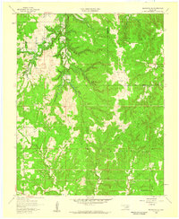
1958 · Mannford SE
USGS Topo · 1:24,000

1958 · Wekiwa
USGS Topo · 1:24,000