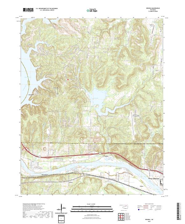
2022 Map of Wekiwa
USGS Topo · Published 2022About this map
The Arkansas River winds through this 2022 survey, marking the intersection of Tulsa, Osage, and Pawnee counties. Along its banks, the settlements of Wekiwa, Lotsee, and Fisher reflect the river-focused geography of this portion of Oklahoma. To the west, the expansive waters of Keystone Lake meet the shoreline at Westport and Gull Bay Landing, creating a landscape defined by significant water management and recreation.
Find a feature on this map
113 named features on this map. Tap any name to fly to it.
Don’t see what you’re looking for? This feature index may not catch every label — zoom into the map to look around manually.
Map Details
Editions of this 2022 Wekiwa Map
This is the sole edition of this map. No revisions or reprints were ever made.
Other maps of this area

1912 · Hominy
USGS Topo · 1:125,000

1915 · Hominy
USGS Topo · 1:125,000

1915 · Hominy
USGS Topo · 1:62,500

1955 · Enid
USGS Topo · 1:250,000

1956 · Sand Springs
USGS Topo · 1:24,000

1956 · Sapulpa North
USGS Topo · 1:24,000

1958 · Enid
USGS Topo · 1:250,000

1958 · Keystone Dam
USGS Topo · 1:24,000
1958 · Mannford SE
USGS Topo · 1:24,000

1958 · Wekiwa
USGS Topo · 1:24,000