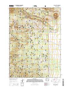
2014 Map of Welch Butte
USGS Topo · Published 2014About this map
Welch Butte stands as a prominent volcanic landmark in this high-altitude landscape within the Winema National Forest. The 2014 survey reveals a transition from the timbered heights of the forest to the arid expanse of the Antelope Desert in the southeast. This portion of Klamath County is defined by its complex drainage systems, with ephemeral and perennial streams such as Cottonwood Cr, Silent Cr, and Desert Cr carving through the volcanic soils. The map documents a specialized network of forest infrastructure, specifically noting several water storage points like Cistern No 8 and Cistern No 14, which are vital for fire management in this dry timber environment. A grid of forest development roads, including Nat For Dev Rd 1370 and Nat For Dev Rd 70, provides the primary access through this remote territory, intersect by the arterial State Hwy 138.
Find a feature on this map
29 named features on this map. Tap any name to fly to it.
Don’t see what you’re looking for? This feature index may not catch every label — zoom into the map to look around manually.
Map Details
Editions of this 2014 Welch Butte Map
This is the sole edition of this map. No revisions or reprints were ever made.
Other maps of this area

1889 · Klamath
USGS Topo · 1:250,000

1891 · Ashland
USGS Topo · 1:250,000

1893 · Ashland
USGS Topo · 1:250,000

1894 · Klamath
USGS Topo · 1:250,000

1897 · Ashland
USGS Topo · 1:250,000

1917 · Diamond Lake
USGS Topo · 1:125,000

1935 · Chemult
USGS Topo · 1:96,000

1941 · Chemult
USGS Topo · 1:125,000

1955 · Crescent
USGS Topo · 1:250,000

1955 · Klamath Falls
USGS Topo · 1:250,000