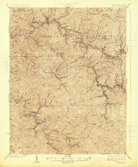
1926 Map of Welch
USGS Topo · Published 1926About this map
The Welch district, at the confluence of Tug Fork and Elkhorn Creek, serves as the primary hub for this McDowell County landscape during a period of intense resource development. The Norfolk and Western railway threads through the narrow valleys, connecting a dense network of coal-company towns and post offices like Coalwood, Gary, and Pando (Juvelina PO). This concentration of settlements reveals the industrial character of the era, where narrow creek bottoms such as Adkin Branch and Browns Creek were bustling with rail activity and mining operations. Beyond the valley floors, the topography rises sharply to heights like Indian Ridge and Belcher Mountain, creating a landscape where community life was physically constrained by the steep terrain. Local genealogy is well-supported by the inclusion of several rural institutions, including the Shannon Branch School and the Long Branch School.
Find a feature on this map
95 named features on this map. Tap any name to fly to it.
Don’t see what you’re looking for? This feature index may not catch every label — zoom into the map to look around manually.
Map Details
Editions of this 1926 Welch Map
3 editions found
Other maps of this area

1887 · Pocahontas
USGS Topo · 1:125,000

1891 · Tazewell
USGS Topo · 1:125,000

1891 · Pocahontas
USGS Topo · 1:125,000

1891 · Oceana
USGS Topo · 1:125,000

1891 · Raleigh
USGS Topo · 1:125,000

1893 · Oceana
USGS Topo · 1:125,000

1894 · Pocahontas
USGS Topo · 1:125,000

1895 · Tazewell
USGS Topo · 1:125,000

1895 · Pocahontas
USGS Topo · 1:125,000

1897 · Tazewell
USGS Topo · 1:125,000