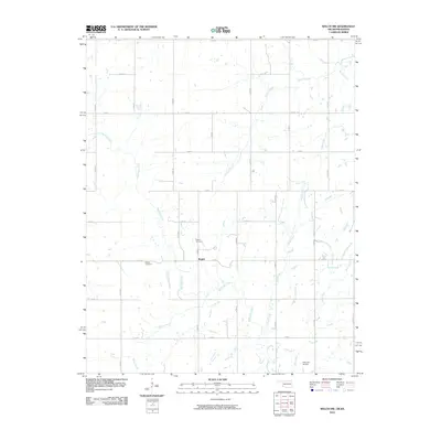
2010 Map of Welch NW
USGS Topo · Published 2010About this map
Rogers and the surrounding agricultural landscapes of northern Oklahoma and southern Kansas are defined by a strict section-line road grid and a dense network of meandering waterways. The drainage pattern is complex, dominated by Big Cabin Creek and its many tributaries, including Russell Creek and Wolfe Creek. For genealogists and local historians, the presence of the Rogers Cemetery near the namesake settlement and the Walker Cemetery to the west provides specific points of interest for family research. While the area is largely rural, the inclusion of Harrison Airport in the south indicates the region's modern transport infrastructure amidst the traditional farm sections and creeks like Willow Creek and Deer Creek.
Find a feature on this map
28 named features on this map. Tap any name to fly to it.
Don’t see what you’re looking for? This feature index may not catch every label — zoom into the map to look around manually.
Map Details
Editions of this 2010 Welch NW Map
This is the sole edition of this map. No revisions or reprints were ever made.
Other maps of this area

1886 · Parsons
USGS Topo · 1:125,000

1893 · Parsons
USGS Topo · 1:125,000

1901 · Vinita
USGS Topo · 1:125,000

1913 · Vinita
USGS Topo · 1:125,000

1944 · Oswego
USGS Topo · 1:62,500

1946 · Oswego
USGS Topo · 1:48,000

1946 · Mound Valley
USGS Topo · 1:62,500

1947 · Joplin
USGS Topo · 1:250,000
1948 · Oswego
USGS Topo · 1:62,500
1948 · Mound Valley
USGS Topo · 1:62,500