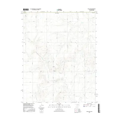
2016 Map of Welch NW
USGS Topo · Published 2016About this map
Rogers serves as the central hub of this northern Craig County landscape, situated amid a grid of rural section roads and winding watercourses. The drainage patterns of the region are defined by Big Cabin Cr and Russell Cr, which weave through the undulating terrain alongside Elm Cr and Wolfe Cr. For local historians and genealogists, the map identifies specific family-named landmarks such as Rogers Cem and Walker Cem, providing precise locations for these early settlement sites. The area is characterized by its agricultural layout, with a dense network of local routes like S 4380 RD and E 60 RD providing access to the various tributaries and homesteads that have shaped the rural character of this Oklahoma territory over many decades.
Find a feature on this map
31 named features on this map. Tap any name to fly to it.
Don’t see what you’re looking for? This feature index may not catch every label — zoom into the map to look around manually.
Map Details
Editions of this 2016 Welch NW Map
This is the sole edition of this map. No revisions or reprints were ever made.
Other maps of this area

1886 · Parsons
USGS Topo · 1:125,000

1893 · Parsons
USGS Topo · 1:125,000

1901 · Vinita
USGS Topo · 1:125,000

1913 · Vinita
USGS Topo · 1:125,000

1944 · Oswego
USGS Topo · 1:62,500

1946 · Oswego
USGS Topo · 1:48,000

1946 · Mound Valley
USGS Topo · 1:62,500

1947 · Joplin
USGS Topo · 1:250,000
1948 · Oswego
USGS Topo · 1:62,500
1948 · Mound Valley
USGS Topo · 1:62,500