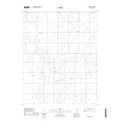
2019 Map of Welch NW
USGS Topo · Published 2019About this map
Rogers is the primary settlement in this portion of Craig County, centered near a network of section-line roads that define the rural landscape. This area is characterized by a dense system of seasonal and perennial waterways, including the winding Big Cabin Cr and its tributaries such as Wolfe Cr and Willow Cr. The map provides specific locations for local genealogical research, marking the Rogers Cem and Walker Cem, which serve as quiet landmarks of the community's long-standing residential history. The terrain is structured by the Public Land Survey System, with boundaries for t28n r19e and t29n r20e clearly delineated. This 2019 survey documents the enduring agricultural layout of the region, where gravel roads like S 4380 RD connect scattered farmsteads across the Oklahoma-Kansas borderlands.
Find a feature on this map
33 named features on this map. Tap any name to fly to it.
Don’t see what you’re looking for? This feature index may not catch every label — zoom into the map to look around manually.
Map Details
Editions of this 2019 Welch NW Map
This is the sole edition of this map. No revisions or reprints were ever made.
Other maps of this area

1886 · Parsons
USGS Topo · 1:125,000

1893 · Parsons
USGS Topo · 1:125,000

1901 · Vinita
USGS Topo · 1:125,000

1913 · Vinita
USGS Topo · 1:125,000

1944 · Oswego
USGS Topo · 1:62,500

1946 · Oswego
USGS Topo · 1:48,000

1946 · Mound Valley
USGS Topo · 1:62,500

1947 · Joplin
USGS Topo · 1:250,000
1948 · Oswego
USGS Topo · 1:62,500
1948 · Mound Valley
USGS Topo · 1:62,500