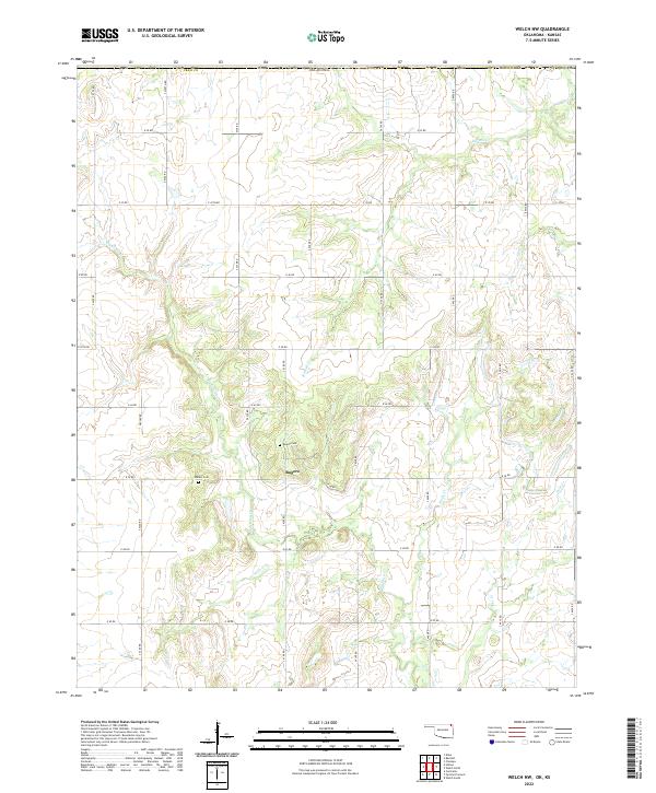
2022 Map of Welch NW
USGS Topo · Published 2022About this map
Big Cabin Cr and its various tributaries define the rural landscape of north-central Craig County in this 2022 survey. The area is characterized by a grid-like network of rural roads that partition the land into agricultural sections, supporting the small settlement of Rogers. Local genealogy and history are anchored by the presence of the Rogers Cem and Walker Cem, which provide specific points of interest for those tracing family roots in this part of Oklahoma. The terrain is shaped by several named water bodies including Russell Cr, Elm Cr, and Wolfe Cr, illustrating the drainage patterns that have long influenced land use in the region. This survey captures the enduring rural character of the vicinity northwest of Welch before modern development might further alter these traditional land divisions.
Find a feature on this map
36 named features on this map. Tap any name to fly to it.
Don’t see what you’re looking for? This feature index may not catch every label — zoom into the map to look around manually.
Map Details
Editions of this 2022 Welch NW Map
This is the sole edition of this map. No revisions or reprints were ever made.
Other maps of this area

1886 · Parsons
USGS Topo · 1:125,000

1893 · Parsons
USGS Topo · 1:125,000

1901 · Vinita
USGS Topo · 1:125,000

1913 · Vinita
USGS Topo · 1:125,000

1944 · Oswego
USGS Topo · 1:62,500

1946 · Oswego
USGS Topo · 1:48,000

1946 · Mound Valley
USGS Topo · 1:62,500

1947 · Joplin
USGS Topo · 1:250,000
1948 · Oswego
USGS Topo · 1:62,500
1948 · Mound Valley
USGS Topo · 1:62,500