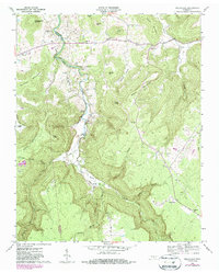
1960 Map of Welchland
USGS Topo · Published 1986About this map
The Rocky River carves a deep path through this portion of the Cumberland Plateau, forming the boundary between Van Buren and Warren counties. The landscape is defined by its dramatic relief, where high points like Baker Mountain and Turkeyscratch Mountain overlook narrow valleys and secluded hollows such as Chestnut Hollow. Small communities and agricultural clearings are found along the river's winding course, including Laurelburg and Riverview.
Find a feature on this map
44 named features on this map. Tap any name to fly to it.
Don’t see what you’re looking for? This feature index may not catch every label — zoom into the map to look around manually.
Map Details
Editions of this 1960 Welchland Map
2 editions found
Other maps of this area

1892 · Pikeville
USGS Topo · 1:125,000

1893 · Mc Minnville
USGS Topo · 1:125,000

1895 · Mc Minnville
USGS Topo · 1:125,000

1895 · Pikeville
USGS Topo · 1:125,000

1935 · Smart Mountain
USGS Topo · 1:24,000

1943 · Cookeville
USGS Topo · 1:100,000

1944 · Cookeville
USGS Topo · 1:100,000
1946 · Smartt Mountain
USGS Topo · 1:24,000
1947 · Smartt Mountain
USGS Topo · 1:24,000

1953 · Chattanooga
USGS Topo · 1:250,000