
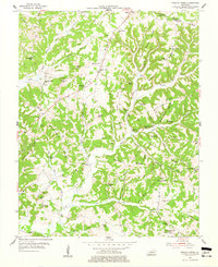
1954 Map of Welchs Creek
USGS Topo · Published 1955About this map
The ridge-and-hollow country of Butler County is defined by steep terrain and tightly clustered rural infrastructure in the mid-1950s. Woods Flat and Bloomington Ridge dominate the central topography, while natural shelters like Skullbone Rockhouse and Grannys Rockhouse offer a window into the local geography of the Squire Ridge area. The settlement pattern is deeply agrarian, anchored by a high density of small community landmarks including Chapel Union Ch, Barnetts Lick Ch, and numerous educational sites like Indian Camp Sch and Dockery Sch.
Find a feature on this map
69 named features on this map. Tap any name to fly to it.
Don’t see what you’re looking for? This feature index may not catch every label — zoom into the map to look around manually.
Map Details
Editions of this 1954 Welchs Creek Map
2 editions found
Other maps of this area

1914 · Little Muddy
USGS Topo · 1:62,500

1922 · Leitchfield
USGS Topo · 1:48,000

1922 · Brownsville
USGS Topo · 1:62,500

1923 · Brownsville
USGS Topo · 1:62,500

1925 · Spring Lick
USGS Topo · 1:62,500

1925 · Leitchfield
USGS Topo · 1:62,500

1953 · Ready
USGS Topo · 1:24,000

1954 · Evansville
USGS Topo · 1:250,000

1954 · Spring Lick
USGS Topo · 1:24,000
1954 · Flener
USGS Topo · 1:24,000