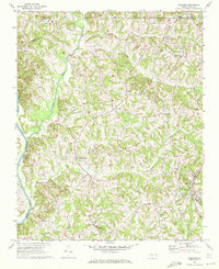
1969 Map of Welcome
USGS Topo · Published 1972About this map
Arcadia and Enterprise anchor the rural landscape of northern Davidson County during the late 1960s, a time when small communities were connected by a network of local churches and winding creek beds. The western edge of the map follows the winding path of the Yadkin River, which serves as a natural boundary with Davie County. Further east, the Winston-Salem Southbound railroad cuts through the terrain near the settlement of Welcome, signaling the importance of rail transport to the local economy.
Find a feature on this map
31 named features on this map. Tap any name to fly to it.
Don’t see what you’re looking for? This feature index may not catch every label — zoom into the map to look around manually.
Map Details
Editions of this 1969 Welcome Map
2 editions found
Other maps of this area

1949 · Eller
USGS Topo · 1:24,000

1950 · Winston-Salem West
USGS Topo · 1:24,000

1950 · Lexington East
USGS Topo · 1:24,000

1950 · Winston-Salem East
USGS Topo · 1:24,000

1950 · Lexington West
USGS Topo · 1:24,000

1950 · Churchland
USGS Topo · 1:24,000

1951 · Winston-Salem West
USGS Topo · 1:24,000

1951 · Winston-Salem East
USGS Topo · 1:24,000

1951 · Churchland
USGS Topo · 1:24,000

1951 · Lexington East
USGS Topo · 1:24,000